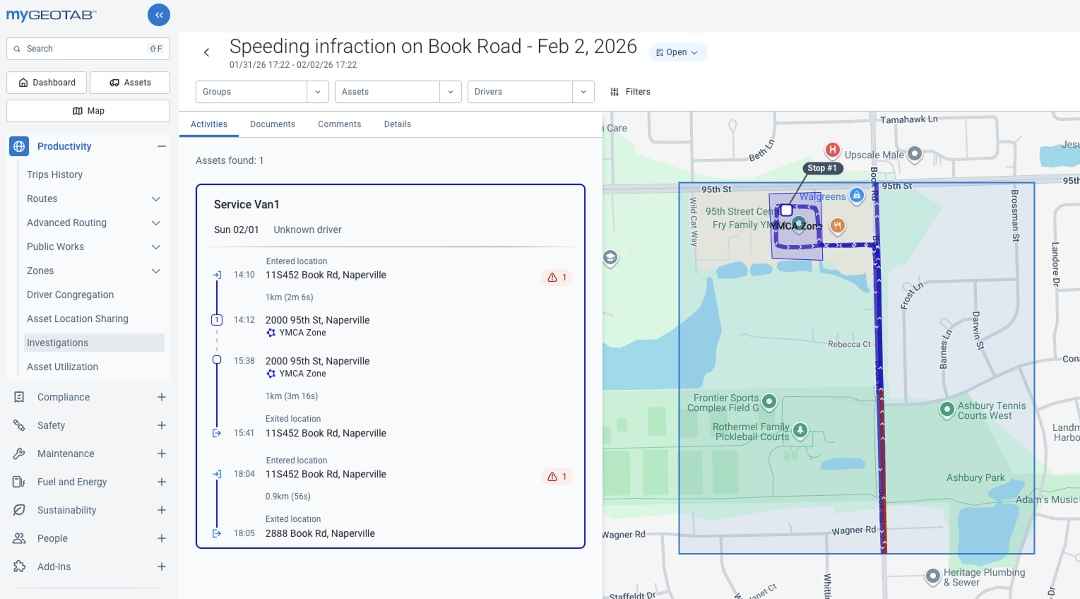
Geotab has launched Geotab Investigations, a solution that brings telematics data and supporting documentation together for fleet safety, compliance, and operations teams investigating road incidents.
Announced August 11, the solution is designed for investigations involving events such as collisions, customer or citizen complaints, property damage, and safety violations. Geotab said these investigations often require information from multiple groups, including operations, safety, insurance, and legal teams.
The company said the process can be manual and fragmented when information is stored across different systems and stakeholders.
“Fleet-related incidents have cost companies billions of dollars in litigation and reputational damage, largely because critical data remains siloed,” said Sabina Martin, vice president of product management at Geotab. “Geotab Investigations changes this by turning raw data into a structured, defensible system of record, providing fleet managers with the intelligence to mitigate risk and the evidence to protect their drivers, operations, and bottom line.”
Geotab Investigations uses existing telematics information to provide a centralized operational view of an incident. Users can search vehicle activity by location and time to identify telematics-based activity associated with an event.
The solution can combine trip information, driver behavior, speed events, and location data to reconstruct a timeline of vehicle movement before, during, and after an incident.
The platform also allows users to attach external materials, including notes, emails, reports, documents, photos, and video, to a case. These materials can be organized with telematics data to provide additional context during an investigation.
Cases can be created and tracked through a structured workflow from opening to closure. The system is intended to provide stakeholders with time-aligned records for operational decisions, insurance claims, compliance requirements, and internal reviews.
Geotab said the use of accurate vehicle and driver data during an investigation can help fleets establish what happened and reduce the risk of incorrectly assigning blame to drivers.
The company said Geotab Investigations is intended to reduce manual effort while providing a consistent way to organize information related to fleet incidents.
Geotab’s release also states that the solution is provided for limited informational purposes and is not an evidence-preservation, legal hold, or custodial service. Customers are responsible for preserving and producing data or evidence required for litigation or investigations, including legal hold and chain-of-custody obligations.
In cases involving potential or actual litigation arising from a collision, Geotab recommends consulting qualified legal counsel. The company said the solution does not provide legal advice or recommendations regarding legal or compliance decisions.
Aug 11, 2026
Lift & Access is part of the Catalyst Communications Network publication family.